
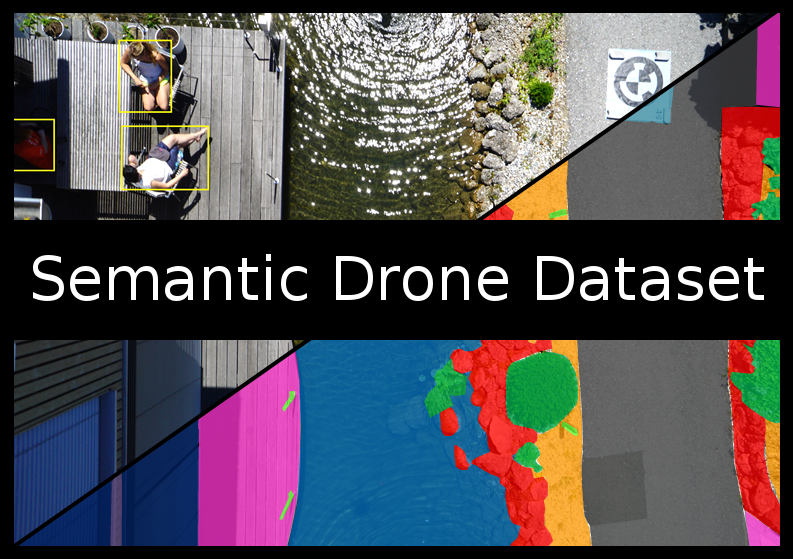
Dataset Overview
The Semantic Drone Dataset focuses on semantic understanding of urban scenes for increasing the safety of autonomous drone flight and landing procedures. The imagery depicts more than 20 houses from nadir (bird’s eye) view acquired at an altitude of 5 to 30 meters above ground. A high resolution camera was used to acquire images at a size of 6000x4000px (24Mpx). The training set contains 400 publicly available images and the test set is made up of 200 private images.
Person Detection
For the task of person detection the dataset contains bounding box annotations of the training and test set.
Semantic Segmentation
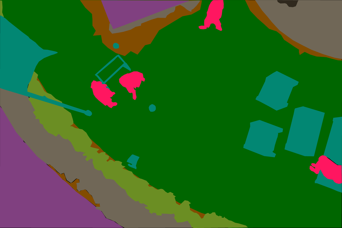
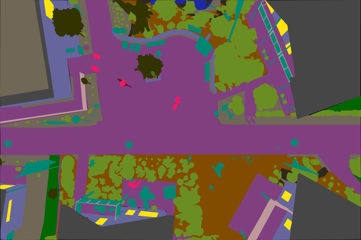
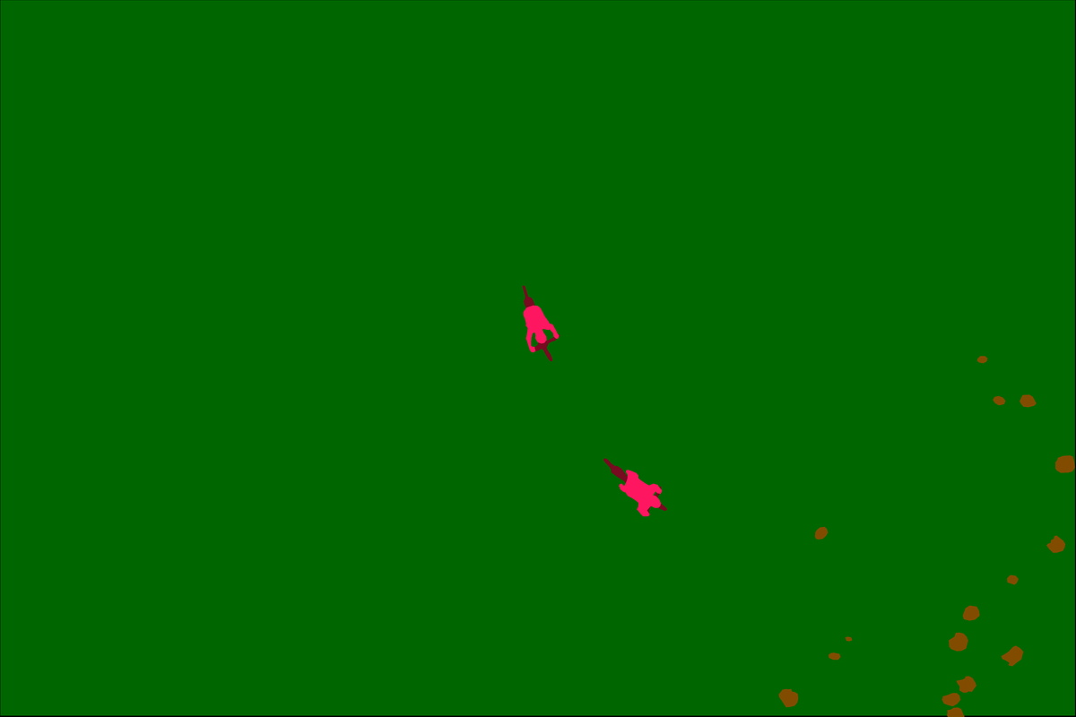
We prepared pixel-accurate annotation for the same training and test set. The complexity of the dataset is limited to 20 classes as listed in the following table. Table 1: Semanic classes of the Drone Dataset
| tree grass other vegetation dirt gravel | rocks water paved area pool person | dog car bicycle roof wall | fence fence-pole window door obstacle |
Additional Data Available
- High resolution images at 1Hz
- Fish-eye stereo images at 5Hz with synchronized IMU measurements
- Thermal images at 1Hz
- Ground control points
- 3D ground truth of 3 houses acquired by a total station
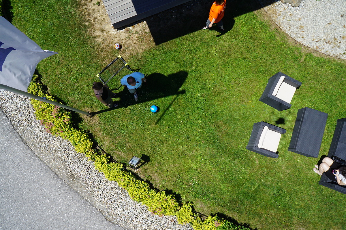
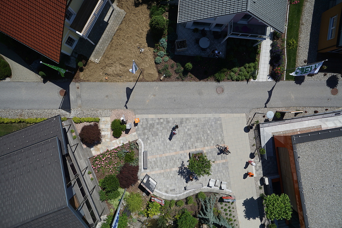
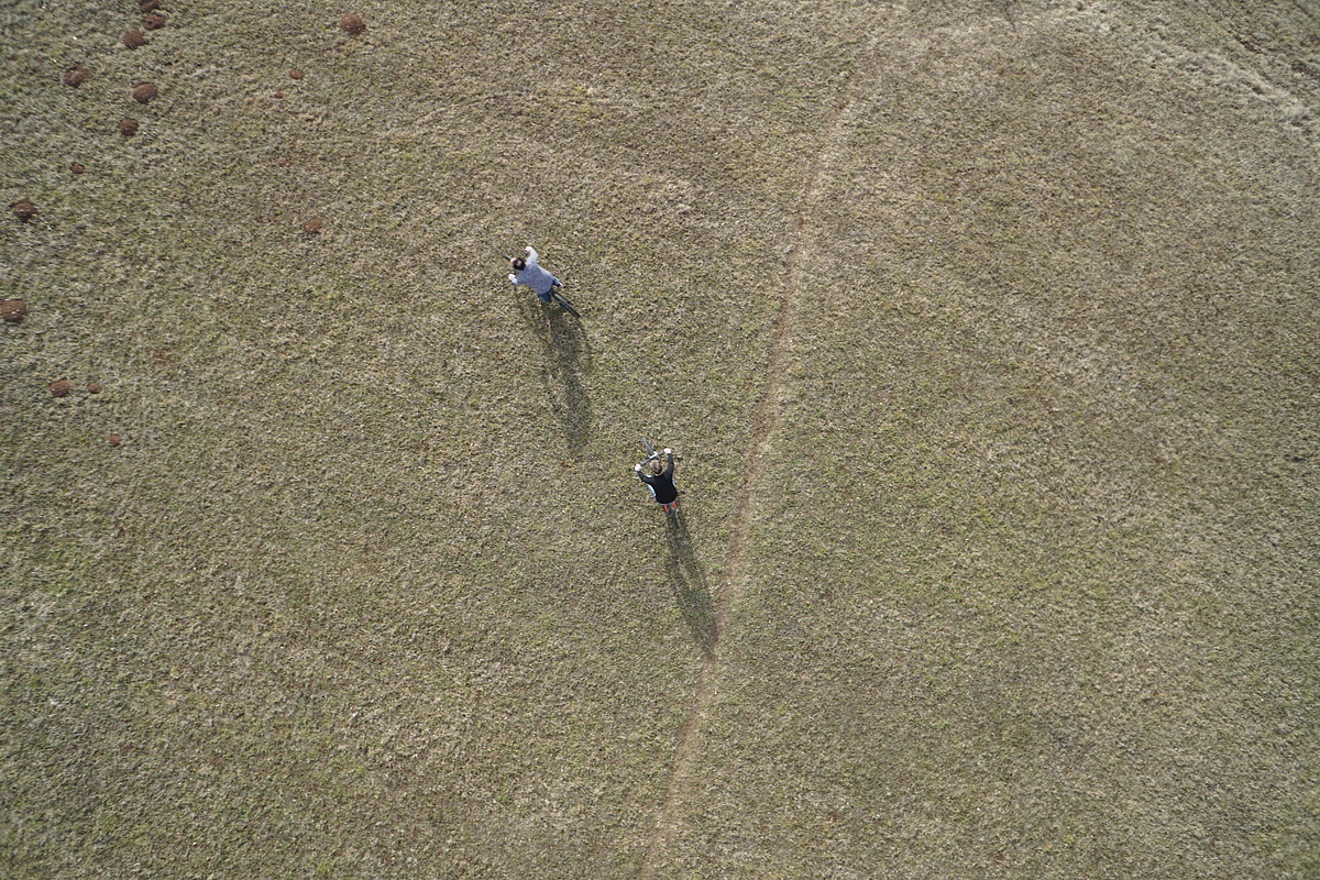
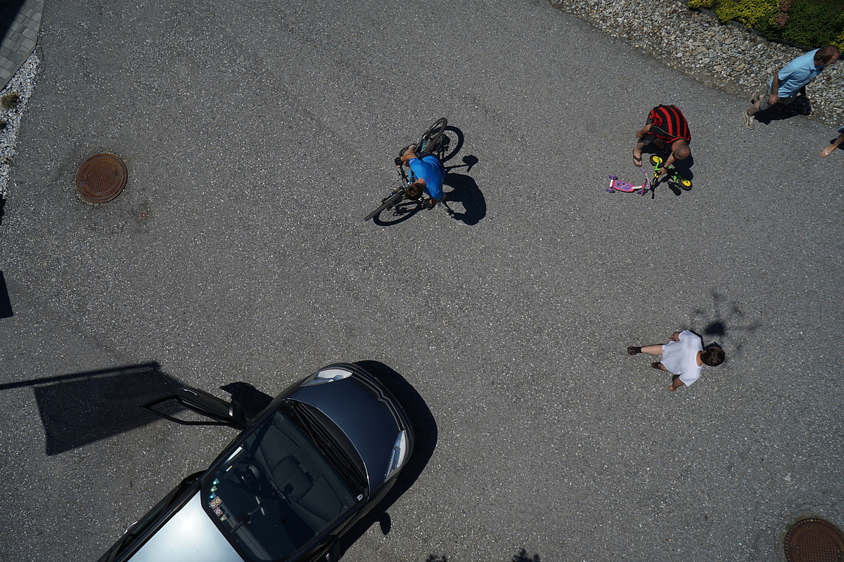
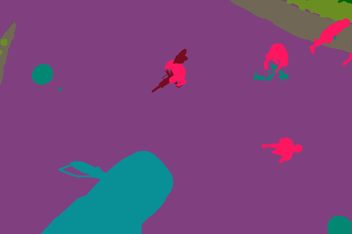
Example images
Citation
If you use this dataset in your research, please cite the following URL:
https://ivc.tugraz.at/tu_ivc_researchproj/semantic-drone-dataset
License
The Drone Dataset is made freely available to academic and non-academic entities for non-commercial purposes such as academic research, teaching, scientific publications, or personal experimentation. Permission is granted to use the data given that you agree:
- That the dataset comes “AS IS”, without express or implied warranty. Although every effort has been made to ensure accuracy, we (Graz University of Technology) do not accept any responsibility for errors or omissions.
- That you include a reference to the Semantic Drone Dataset in any work that makes use of the dataset. For research papers or other media link to the Semantic Drone Dataset webpage.
- That you do not distribute this dataset or modified versions. It is permissible to distribute derivative works in as far as they are abstract representations of this dataset (such as models trained on it or additional annotations that do not directly include any of our data) and do not allow to recover the dataset or something similar in character.
- That you may not use the dataset or any derivative work for commercial purposes as, for example, licensing or selling the data, or using the data with a purpose to procure a commercial gain.
- That all rights not expressly granted to you are reserved by us (Graz University of Technology).
Download
The data set can be downloaded using this link.
Contents of the training set:
- Images
- Bounding boxes as python pickle file
- (optional) Bounding boxes as xml
- (optional) Bounding boxes as mask images
Acknowledgement
We would like to thank Prof. Werner Lienhart and Dipl.-Ing Slaven Kalenjuk of the Institute of Engineering Geodesy and Measurement Systems (IGMS), Graz University of Technology for supporting us by acquiring the 3D ground truth data using a total station.